Past IEM Features tagged: mississippi
Mississippi River Flooding
28 Apr 2023 05:30 AMIt was an epic winter for accumulating snowfall to the north of Iowa. Much of this snowfall has melted and is now flowing south via the Mississippi River to produce flooding. It is somewhat fortunate that dry weather in Iowa and elsewhere this month has not added to stream flows. The featured chart presents recent USGS/NWS stage observations and forecasts for Guttenburg (northeastern Iowa). It shows a forecast crest happening Friday/Saturday and then receding afterwards. The crest reaching 21 feet would put it into "major flooding" category. These forecasts make assumptions about expected rainfall and rainfall runoff impacts take time to reach the Mississippi, so near-term unexpected heavy rainfall events and future events currently outside of the forecast window will impact future river stage observations.
Voting:
Good: 18
Bad: 0
Tags: flood mississippi
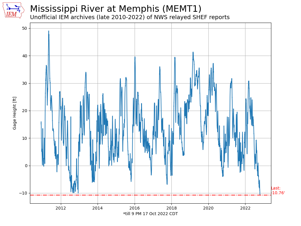
Low Mississippi River
18 Oct 2022 05:30 AMThe ongoing drought is having a very significant impact on water levels along the Mississippi River. The gage height reported by the Memphis, TN sensor hit a record low value on Monday at -10.71 feet, which bested the previous record low stage set in 1988. The IEM has archives of these river gage reports, but only back to late 2010. The featured chart presents the gage height reports for the site with the red line representing the value at 9 PM Monday. You can see the current value dipping below the low flows during the drought of 2012. A major impact is reduced barge traffic, which is important for moving agricultural crops from Iowa to elsewhere.
Voting:
Good: 13
Bad: 1
Tags: mississippi drought


