Past IEM Features tagged: may212024
Greenfield Tornado
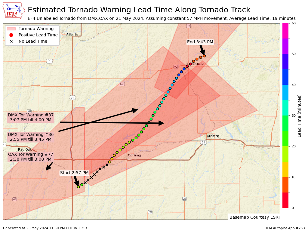
24 May 2024 05:30 AMYesterday's daily feature map of the Polk/Story Tornado Track from Tuesday was well received, so today's map shows the current and preliminary NWS track for the tornado that hit Greenfield, IA. The map combines NWS Tornado Warnings with the tornado track and attempts to assess lead time at one minute interval points along the track. There are caveats galore with this type of analysis as the algorithm assumes a constant ground speed and has a very rigid and binary spatial/temporal match between the track points and the polygons. For example, the x's indicate times that the tornado was temporally and spatially outside of the warning, but there was an active warning less than 0.5 miles to the west. Additionally, the points near Greenfield are shown with a very short lead time, but previous warnings were within a mile with plenty of lead-time. So for what it is worth, you can now generate these maps on-demand for other tornado tracks found within the NWS Damage Assessment Toolkit (DAT).
Voting:
Good: 33
Bad: 1
Tags: dat may212024
Polk-Story Tornado
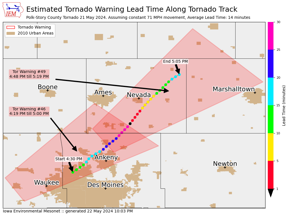
23 May 2024 05:30 AMAfter damaging tornadoes, the National Weather Service conducts damage surveys to document the tornado track and produce EF-scale ratings based on damage indicators found during the survey. On Wednesday, NWS Des Moines released a preliminary survey track for the tornado that tracked from near Grimes to Zearing. The featured map combines this track along with its estimated start/end times and underlays the two tornado warnings covering this event. The track is discretized into one minute interval points with each point evaluated for lead time with the associated first overlapping warning. The map is attempting to illustrate the varying lead time somebody along this track may have experienced. There are many caveats to a map like this as somebody just outside of the first warning would still have likely experienced a heads up with a greater lead time that is shown by the plot. This tornado is currently rated as a EF-2. Additional damage surveys will come up over the coming days, including the most significant tornado directly hitting Greenfield. Here are links to NWS Des Moines, NWS Davenport, and NWS La Crosse event summary pages.
Voting:
Good: 23
Bad: 1
Tags: may212024
May 21
22 May 2024 05:58 AMThe severe weather threat on Tuesday materialized and then some with numerous damaging tornadoes reported along with wind, hail, and flooding rains. The featured movie lapses a NEXRAD mosaic between 10 AM and midnight with NWS Local Storm Reports plotted. The event got started early and storms moved very quickly off to the north and east. An interactive map is available of this event detailing the warnings issued and local storm reports received by the NWS.
Voting:
Good: 15
Bad: 0
Tags: may212024

