Past IEM Features tagged: sep18
Wettest September
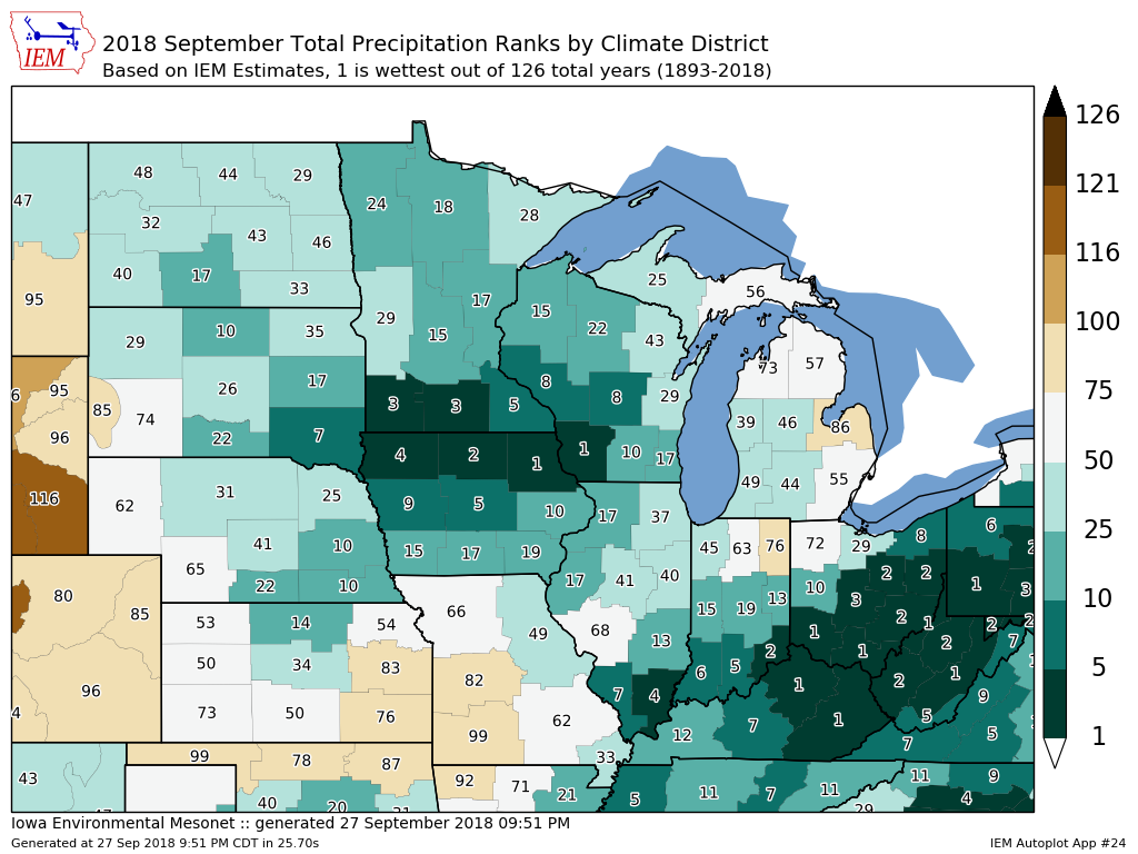
28 Sep 2018 05:34 AMThe featured map presents IEM estimated climate district ranks for total precipitation this September. Please note that these values are up until 27 September, so with three more days to go, the shown ranks could decrease further. Even after having said that, some of the districts shown are already at the wettest on record. For Iowa, that includes the northeastern district. A daily feature early this week denoted that Waterloo (sw corner of this district) had its wettest month on record for any month. The near term forecast hits this wettest area hard over the coming week with even more rainfall.
Voting:
Good: 11
Bad: 0
Tags: sep18
Record Four Day Rainfall
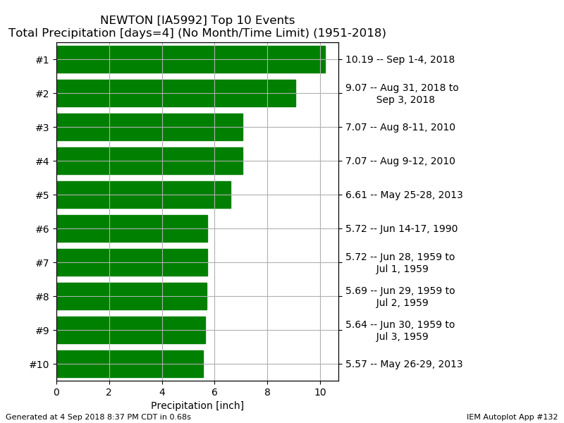
05 Sep 2018 05:18 AMRainfall totals continue to pile up and now to add insult to injury, a slug of moisture from Tropical Storm Gordon is headed our way. The featured chart shows maximum four day precipitation totals for Newton. Based on preliminary data, the first four days of this September were the wettest four on record for the site with over ten inches reported. If there is any good news in all of this, the heaviest rains over the next few days are expected to stay south of the heaviest rainfall totals that fell so far this month.
Voting:
Good: 8
Bad: 1
Tags: sep18

