Past IEM Features tagged: 2022
Wrapping up 2022
27 Dec 2022 05:30 AMWith just five days left of 2022, it is a good time to start summarizing the year that was. A significant weather story this year was the drought, that was most persistent over NW Iowa. The epicenter was Sioux City, which reached the worst drought classification of "D4". The featured chart presents the year to date accumulated precipitation along with the range of values on record and the accumulated values for last year and the drought year of 2012. The accumulated total for 2022 was at the very bottom of the range from mid July to early December. A few recent precipitation events have pushed the total above the lowest on record, but not by much.
Voting:
Good: 12
Bad: 0
Tags: 2022
Sioux City Struggles
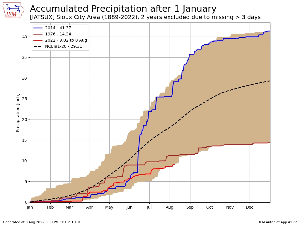
10 Aug 2022 05:30 AMPrecipitation has been a struggle this summer over much of Iowa. For parts of NW Iowa, the struggle has been real for the entire calendar year as shown by the featured chart of year to date accumulated precipitation. The red line is this year's accumulation and is shown at the bottom of the range of values for the date. Rewording, the year to date accumulation this year is the lowest on record for the site at just over nine inches. The wettest and driest full year is plotted as well along with the present NCEI climatology. It is too bad that all that rain that fell just north over Sioux Falls on Sunday could not have been shared a bit further south.
Voting:
Good: 15
Bad: 0
Tags: 2022

