IEM Daily Feature
Tuesday, 03 December 2024
Tuesday, 03 December 2024
'24-'25 Winter Storm #1
Posted: 03 Dec 2024 05:30 AM
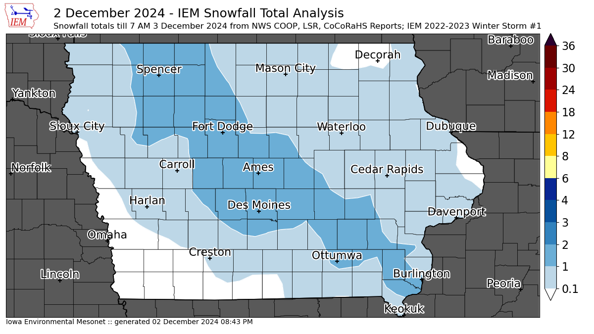
The first wide spread snowfall over Iowa of the season fell on Monday with most locations picking up 1.5 inches or less. There were a couple of isolated two inch reports, so this met the arbitrary threshold for the IEM to generate a snowfall event map. The featured map presents an analysis of available NWS and CoCoRaHS reports. This snowfall was tremendously fluffy with snow to liquid water equivalent (SWE) ratios around 40 and above. A more typical SWE value in Iowa is closer to 13, so it was certainly not much trouble to shovel such fluff away. You can find more maps like these for previous winters by clicking the winter2425 tag associated with this feature post.
Voting:
Good = 11
Bad = 0
Tags: winter2425
Voting:
Good = 11
Bad = 0
Tags: winter2425

