IEM Daily Feature
Tuesday, 15 November 2022
Tuesday, 15 November 2022
'22-'23 Winter Storm #1
Posted: 15 Nov 2022 07:47 AM
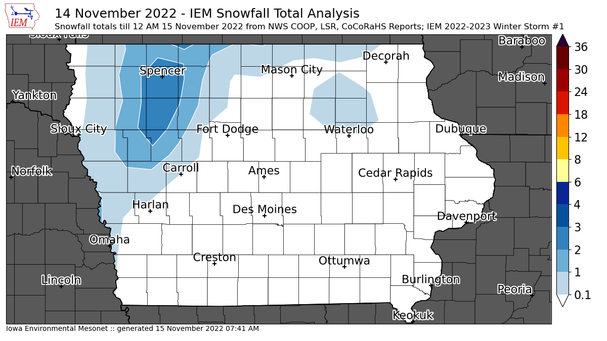
Each year the IEM Daily feature attempts to document snowfall totals from individual storm events. The
informal policy is for a storm to produce at least two inches of snow and/or create significant travel
impacts. While some parts of Iowa have seen light snow prior to yesterday, totals were very light from
those events and thus not counted here. This first significant snowfall event of the season is a tricky
one as the second event is already here this Tuesday morning and thus some of the 24 hour reported
snowfall totals covered parts of both storms. So some care was taken with the featured map to exclude
those totals covering the second storm from this map. Caveat emptor... So the highest totals from the
first wave according to available NWS COOP, Local Storm Reports and CoCoRaHS reports were
confined to northwestern Iowa.
Voting:
Good = 16
Bad = 0
Tags: winter2223
Voting:
Good = 16
Bad = 0
Tags: winter2223

