IEM Daily Feature
Thursday, 22 August 2013
Thursday, 22 August 2013
Dewpoint Depression
Posted: 22 Aug 2013 05:46 AM
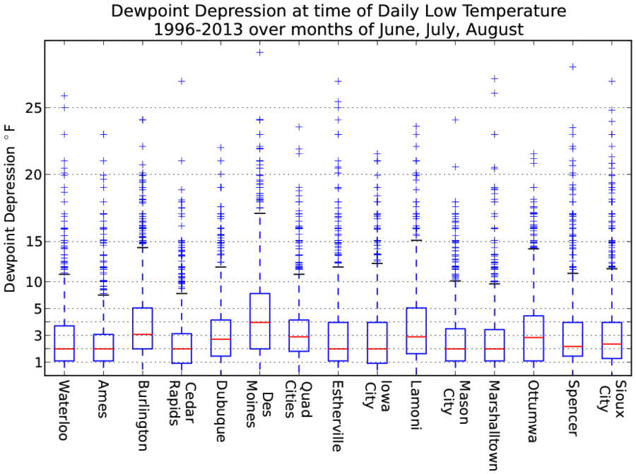
Yesterday's feature looked at the afternoon dew point being an
indicator of the next day's low temperature. The theory being that the
air temperature would cool off to the dew point temperature and thus be
the low temperature. Today's feature looks at the distribution of
dewpoint depression at the time of the daily low temperature for each
of the ASOS sites in the state. The dewpoint depression is simply the
difference between the air and dewpoint temperature. Differences
between sites are likely due to micro-climate effects as each ASOS has
different surroundings which include soil types, vegetation, and amount
of urban area / concrete around it. The chart shows a large difference
between Ames and Des Moines with the median dewpoint depression two
degrees less at Ames. The first guess explanation for this difference
is the larger urban heat island effect at Des Moines, which would tend
to keep the temperature higher and further away from the dewpoint than
surrounding locations. Also, the Ames ASOS is located in a topographic
depression which would promote cooler temperatures.
Additional plots: same plot for high temperatures, Ames weekly dewpoint depression, and weekly for Des Moines.
Voting:
Good = 123
Bad = 12
Tags: dewpoint asos heatisland