IEM Daily Feature
Tuesday, 20 July 2010
Tuesday, 20 July 2010
And yet another heavy rainfall
Posted: 20 Jul 2010 10:12 AM
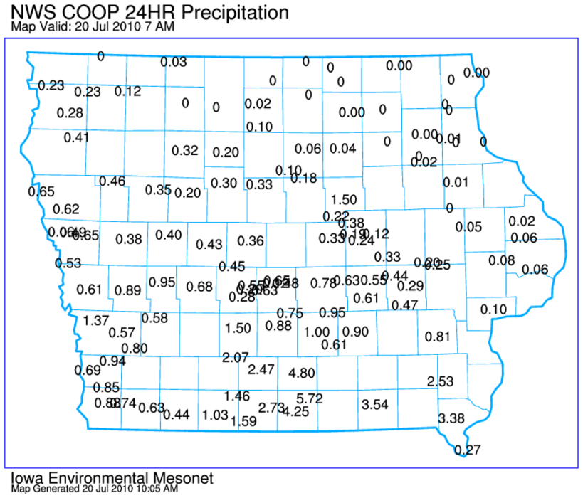
A stalled out front helped to focus thunderstorm development last
night over southern Iowa and the storms did not leave the area until
this morning. The featured map displays NWS COOP rainfall reports at
7 AM this morning with parts of Wayne and Appanoose counties well over
four inches. Unfortunately, more storms are in the forecast as the
seemingly non-stop storms since the beginning of June continues.
Voting:
Good = 14
Bad = 5
Voting:
Good = 14
Bad = 5

