IEM Daily Feature
Tuesday, 09 July 2024
Tuesday, 09 July 2024
Beryl Tornado Warnings
Posted: 09 Jul 2024 05:30 AM
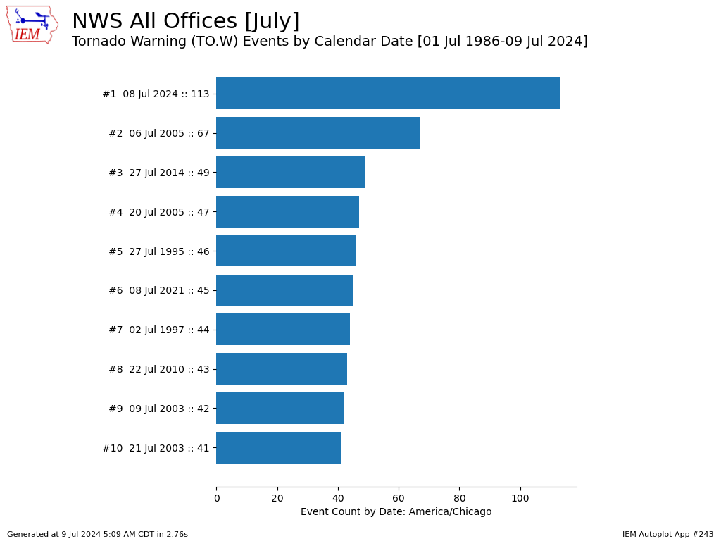
While over the ocean, Hurricane Beryl was a historic tropical system for a number of reasons including reaching category 5 status so early in the season, its longevity, the region it developed in, and regaining Hurricane status after a significant incursion of dry air and hostile shear environment. So it makes sense that it continued to make history after landfall on Texas early Monday morning. The storm did significant damage along the gulf coast from the traditional threats of rainfall, storm surge, and wind. It then transitioned into a prodigious tornado producer as the right front quadrant of the storm was in an abnormally primed environment to produce tornadoes. The NWS followed suit and issued a large number of tornado warnings for the date. It is difficult to state how anomalous this event was given that it happened during the first half of July. The featured chart presents an IEM accounting of the largest number of tornado warnings issued by the NWS for a July date. NWS Shreveport issued 67 warnings itself yesterday, which matches the previous NWS-wide max total for a US Central calendar day in July! Yesterday also made for the 6th day this year with over 100 tornado warnings, which places 2024 in second place for such a metric behind nine days during 2011.
Voting:
Good = 14
Bad = 1
Voting:
Good = 14
Bad = 1

