IEM Daily Feature
Wednesday, 05 June 2024
Wednesday, 05 June 2024
Record Start for DVN
Posted: 05 Jun 2024 05:30 AM
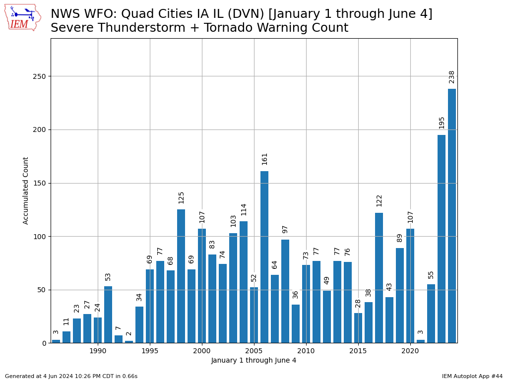
A bit of severe weather rolled through Iowa on Tuesday with the NWS offices covering the state issuing a handful of warnings. It has been a rather active year for severe weather as evidenced by the featured chart. It presents an IEM accounting of office issued severe thunderstorm and tornado warnings since 1986. An import caveat is that this office did not exist in its present form in 1986, but there were many smaller offices around at the time. Some IEM work many years ago attempted to rectify all these warnings into the present day office, but it was not perfect and data quality / archive completeness prior to the early 1990s is always of concern. All those concerns put aside, the total for 2024 is easily the largest on record for the year to date period. It stands in remarkable contrast to the total of three just three years ago in 2021.
Voting:
Good = 12
Bad = 0
Voting:
Good = 12
Bad = 0