IEM Daily Feature
Monday, 25 March 2024
Monday, 25 March 2024
'23-'24 Winter Storm #14
Posted: 25 Mar 2024 10:35 AM
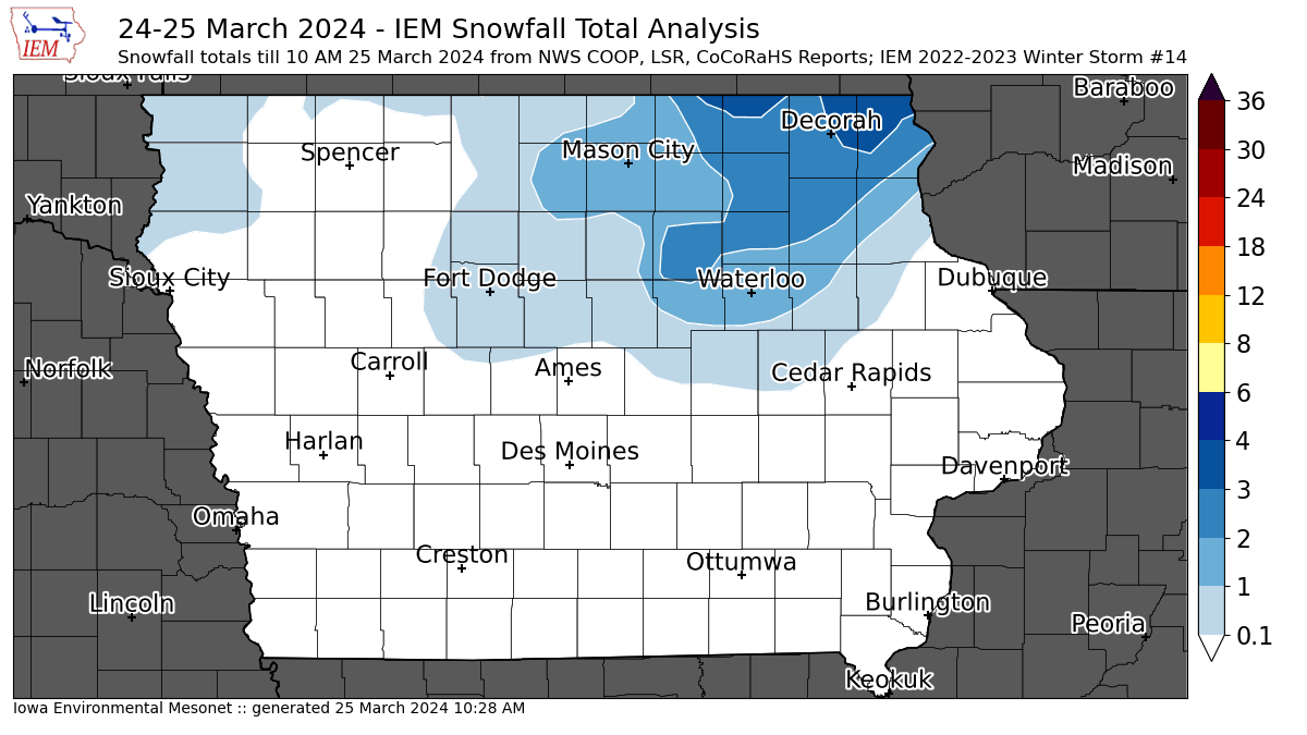
The IEM's unofficial accounting of winter storms gets to be tricky when a long duration winter storm impacts the state with much of the snow melting before once daily observations are taken. So the featured map provides an analysis of reports for the snowfall from Sunday morning with some of the light totals from NW Iowa happening perhaps on Monday. Most of the state is well above freezing this Monday with numerous rounds of showers and thunderstorms expected today. Blizzard conditions are just off to our north and west with the heaviest totals found there. This very wet storm system will be very beneficial to make up some accumulated precipitation deficits. There is an additional chance of snow from this system overnight Monday into Tuesday, so those reports may get lumped into a new storm accounting if reported accumulations warrant.
Voting:
Good = 10
Bad = 2
Tags: winter2324
Voting:
Good = 10
Bad = 2
Tags: winter2324