IEM Daily Feature
Wednesday, 13 December 2023
Wednesday, 13 December 2023
Extreme Dryness
Posted: 13 Dec 2023 05:30 AM
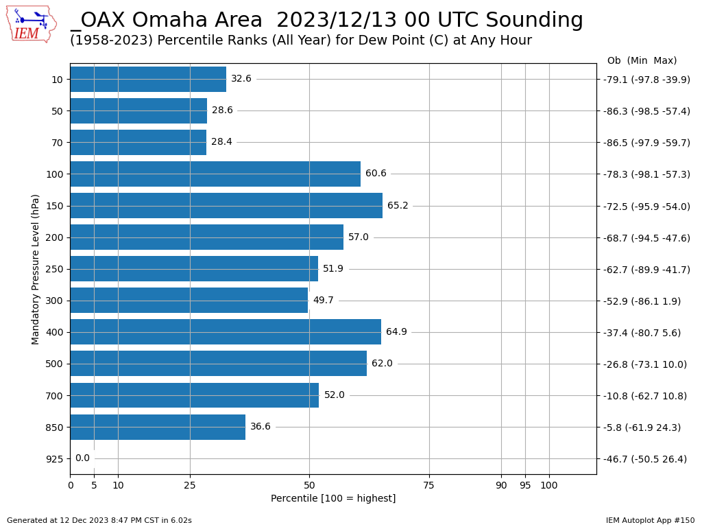
Those of you that monitor RADAR every day probably noticed the reflectivity returns work into southwestern Iowa late Tuesday afternoon and evening. These returns were not producing much at the ground level as extremely dry air was present between the falling water aloft and ground. The Omaha sounding launched Tuesday evening captured an astounding -46.7 Celsius dew point temperature at 925 hPa. For those of you hoping for English units, the dew point was -52 Fahrenheit at about 1500 feet above the ground. The featured chart presents how the Tuesday evening sounding for dew point temperature compared with the period of record archive for the site at the various mandatory observation levels. For the 925 hPa level, this was just shy of the coldest/driest value observed on record. A manual computation found this profile to be the second driest behind that -50.5C value on 29 Feb 2010 at 0 UTC. Such extremely dry air masses typically originate from stratosphere and are brought to the near surface via energetic storm systems.
Voting:
Good = 14
Bad = 0
Tags: sounding dry
Voting:
Good = 14
Bad = 0
Tags: sounding dry