IEM Daily Feature
Thursday, 05 October 2023
Thursday, 05 October 2023
Since D4 Introduction
Posted: 05 Oct 2023 05:30 AM
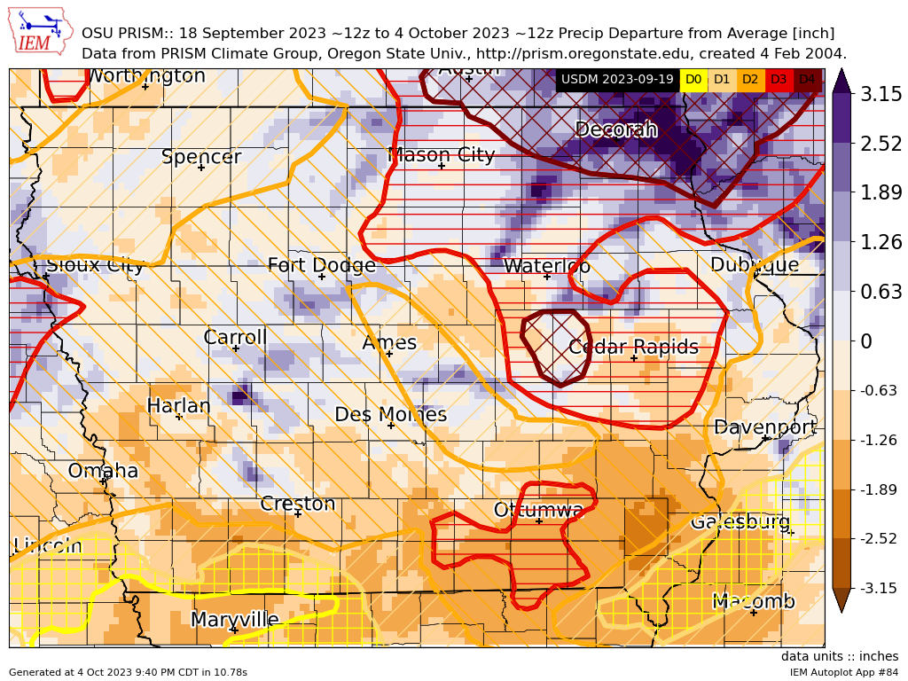
Two weeks ago, the weekly US Drought Monitor introduced D4 classification for drought over portions of eastern Iowa. The D4 level is the most severe drought classification and very rare for Iowa. Of course, this provoked mother nature to finally produce a number of rainfall events over the area and the following week's Drought Monitor update removed the just introduced D4 over far northeastern Iowa, but the D4 area west of Cedar Rapids remained. The featured map presents two week rainfall departures from average based on OSU PRISM data and the drought monitor analysis valid two weeks ago when the D4 was introduced. You can see the large positive departures over far northeastern Iowa that lead to its removal. You can also see the lack of significant rain over the second D4 area and even continued dryness to the immediate area east of there. This week's Drought Monitor update arrives in a couple of hours and it will be interesting to see if this D4 area is expanded as the recent rainfall events have missed the area.
Voting:
Good = 9
Bad = 1
Voting:
Good = 9
Bad = 1

