IEM Daily Feature
Monday, 10 October 2022
Monday, 10 October 2022
Overnight Cooling Fun
Posted: 10 Oct 2022 05:30 AM
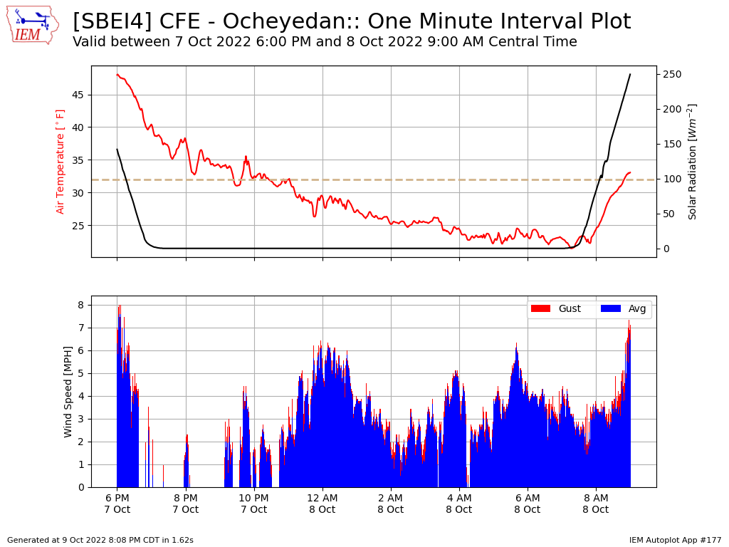
Temperatures got very chilly Saturday morning with many locations in northern Iowa dipping well into
the 20s and even a 19 degree low reported at Sheldon. The featured chart presents a one minute time
series plot from the ISU Soil Moisture site near Ocheyedan from Friday night into Saturday morning.
The top panel shows the combination of air temperature and solar radiation. The bottom panel shows
minute averaged wind speeds and gusts. There is a lot of really fun things happening with this chart.
The strong cooling overnight continued until just after sunrise when incoming radiation eclipses the long
wave outgoing radiation. There's lots of variability shown with rapid jumps up and down in temperature
during the overnight hours. These events can be correlated with the jumps and cessation of wind as
wind generally indicates vertical mixing, which would have been transporting warmer air downward.
Another interesting phenomena is the interaction around the freezing line (dashed line). When water
freezes, heat is released and can cause a delay in further cooling. There is also an inertia in the other
direction as melting consumes heat and will cause a delay in further warming. There are hints to both
processes in the chart, but it is not as strong as during cases of having lots more water around (ie snow
cover / recent rain event).
Voting:
Good = 8
Bad = 0
Voting:
Good = 8
Bad = 0