IEM Daily Feature
Tuesday, 05 July 2022
Tuesday, 05 July 2022
Drought Evaluation Time
Posted: 05 Jul 2022 05:32 AM
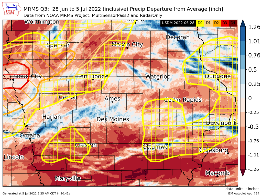
The weekly US Drought Monitor considers the past seven days of precipitation up until Tuesday
morning to produce an updated analysis released on Thursday morning. So the featured map presents
the combination of the past seven days MRMS estimated precipitation departures from average along
with the Drought Monitor from last week. Of course, one map does not tell the complete story in the
process of updating the analyzed drought, but this map at least indicates areas that have the potential
for improvements or degradation. The big rains on July 4th mostly missed far southern Iowa and this
area continues to be trending dry. Clayton County (far NE Iowa) got some significant rainfall last night
and maybe could see some improvements. Rainfall patterns are often complex and at a finer spatial
scale than what attempts to be captured by the drought monitor.
Voting:
Good = 18
Bad = 0
Voting:
Good = 18
Bad = 0

