IEM Daily Feature
Tuesday, 28 June 2022
Tuesday, 28 June 2022
Flash Drought Concerns
Posted: 28 Jun 2022 05:30 AM
The term "Flash Drought" has been receiving a fair bit of press coverage lately as some parts of the
Midwest and Great Plains have turned dry and hot this June. The combination of climatological max
precipitation accumulation with dry weather, highest solar radiation, warming soils and developing crops
can combine to quickly turn marginally wet springs into significant moisture deficits that cause plant
stress to appear. Such is the case over parts of Iowa that have missed out on recent June rainfalls.
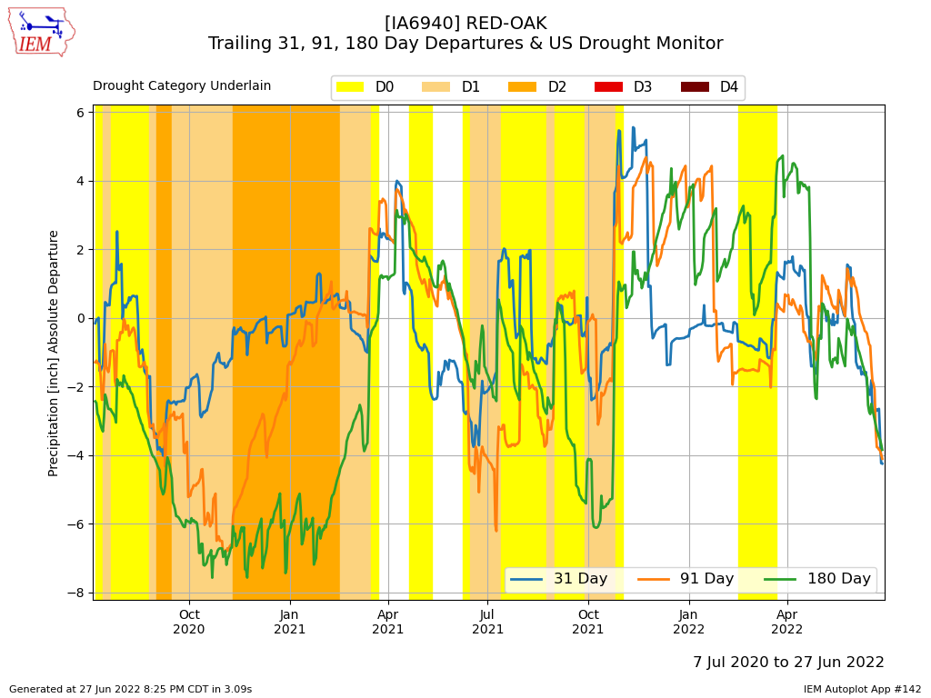
The featured chart presents data for Red Oak (far SW Iowa). The chart combines trailing 30, 91 and
180 day precipitation departures along with analyzed US Drought Monitor category at the time. The
recent few weeks have seen a quick nose dive of all three precipitation metrics and will likely receive
close attention with the weekly Drought Monitor update due on Thursday.
Voting:
Good = 11
Bad = 0
Voting:
Good = 11
Bad = 0

