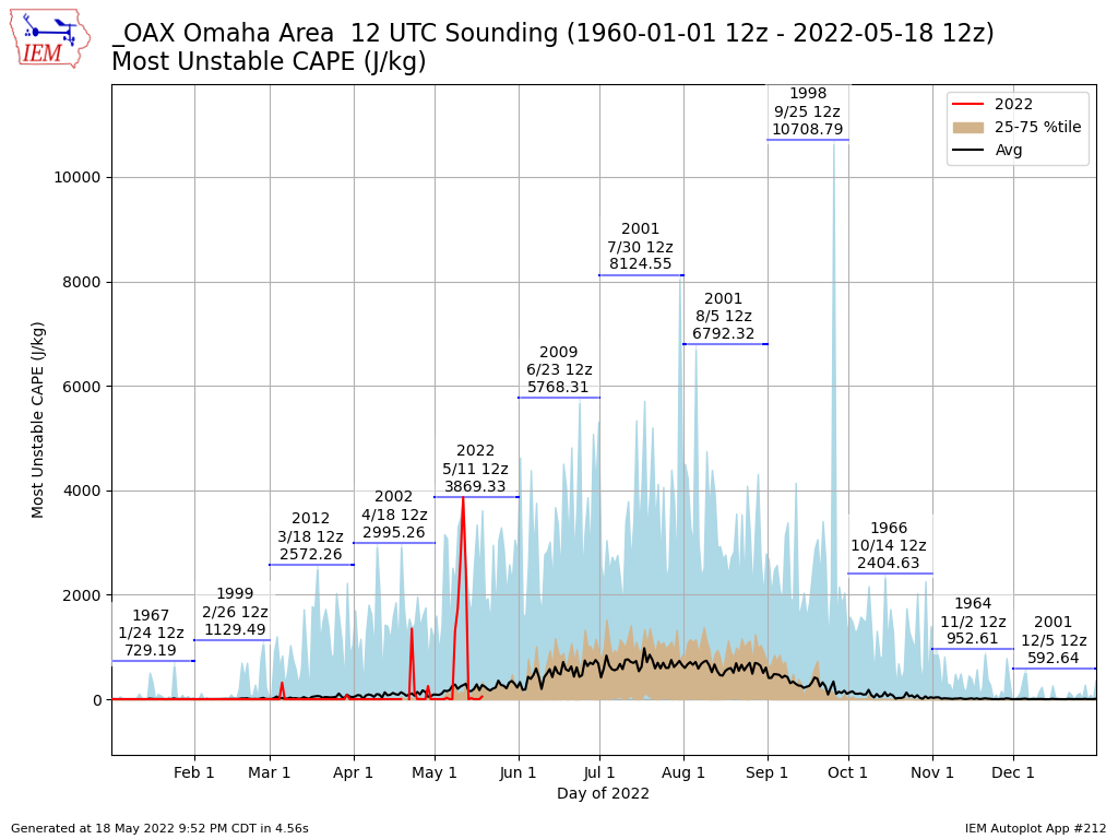
Unstable Morning Sounding
Posted:
The warmth and humidity of last week was rather exceptional with a number of records being set for
early season maximums of each. This combination helps to drive thunderstorm activity as warm and
moist air is lifted, water condenses and latent heat is released which can accelerate updrafts. One
assessment of instability present in the atmosphere is a parameter called Most Unstable Convective
Available Potential Energy (MUCAPE). This parameter is sort of a best case scenario for the amount of
energy available. The parameter can be computed via the twice day atmospheric soundings made by
the NWS. The featured chart presents the MUCAPE value for the morning launch at 12 UTC (7 AM
CDT) for Omaha. A time series of this year's values are presented along with some statistical values
based on period of record data. The max value each month is labelled with the sounding that
generated that value. According to unofficial IEM accounting, the morning sounding last week for
Omaha was a record for the month of May. Instability typically is lower during the morning hours as the
lower atmosphere stabilizes during the overnight hours. So having large MUCAPE values in the
morning is remarkable. (Apologies, as this featured chart is about a week delayed due to some archive
quality issues that needed resolved.)
Voting:
Good = 16
Bad = 0
Voting:
Good = 16
Bad = 0
