IEM Daily Feature
Tuesday, 14 December 2021
Tuesday, 14 December 2021
High Wind Watch
Posted: 14 Dec 2021 05:34 AM
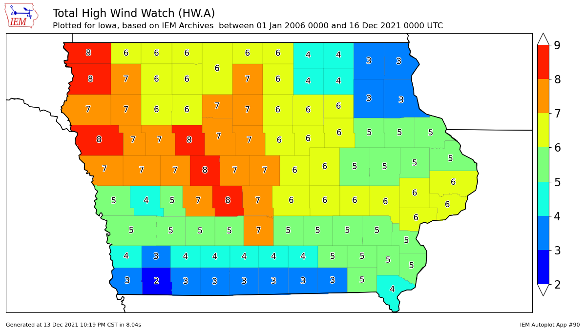
The upcoming wind storm along with any thunderstorms continue to be of top concern among weather
forecasters for Wednesday into Thursday morning. The NWS issued a somewhat rare High Wind
Watch for much of Iowa. The featured chart presents the number of such events with data back to
2006. For far southern and northeastern Iowa (both currently under the watch), there's very few other
event during this period. Other portions of the state are necessarily not all that more frequent as this
alert type is reserved for the most extreme of events. Any storms that are able to form will likely only
increase the wind speeds as such storms typically transport higher velocity air aloft to the surface.
While very strong to damaging winds seem to be a given at this point, the tornado threat remains less
certain but will need to be closely watched. Storm motion will be very fast and these storms will come
during the night time.
Voting:
Good = 21
Bad = 0
Voting:
Good = 21
Bad = 0

