IEM Daily Feature
Wednesday, 24 March 2021
Wednesday, 24 March 2021
SWAW 2021: Tornadoes
Posted: 24 Mar 2021 05:36 AM
Wednesday's topic for Severe Weather Awareness Week (SWAW) is tornadoes. For many Iowans,
tornadoes are the most frightening weather phenomena and something that many folks actively run
practice drills for. The NWS issues a tornado warning when a tornado is observed and/or indicated
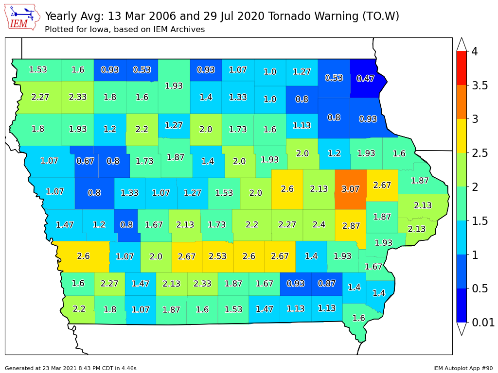
to be imminent by Doppler RADAR. The featured map presents the average number of tornado
warnings per year by county over the past 15 years. Please note that the official warning presently
are polygon geographies, but the counties are still used by some warning dissemination systems.
Linn County (Cedar Rapids) shows up with the highest frequency on the map with other urban
centers clearly visible as well. There are many complexities as to why such variability exists over the
state, but distance from the nearest RADAR is an important aspect as the earth's curvature causes
the RADAR to miss the lowest parts (which are sometimes the rotating ones) as the beam travels
further away from the RADAR site.
Voting:
Good = 17
Bad = 0
Voting:
Good = 17
Bad = 0

