IEM Daily Feature
Wednesday, 04 March 2020
Wednesday, 04 March 2020
Welcome Dryness
Posted: 04 Mar 2020 05:36 AM
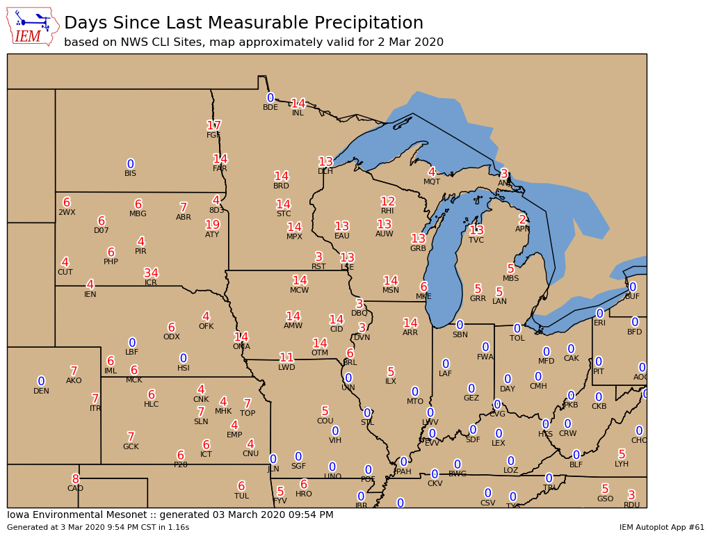
The featured map displays the number of days since the last measurable precipitation based on
NWS primary reporting stations up until Monday. A decent portion of the upper Midwest is shown in
the two to three week range, including much of Iowa. This dry weather has been a welcome break
from recent months of very wet conditions. We likely can use all the dry weather we can get as soils
remain saturated from the very wet fall season last year. Some light rain and snow fell over portions
of Iowa overnight ending the dry stretch for some.
Voting:
Good = 11
Bad = 0
Voting:
Good = 11
Bad = 0