IEM Daily Feature
Thursday, 28 March 2019
Thursday, 28 March 2019
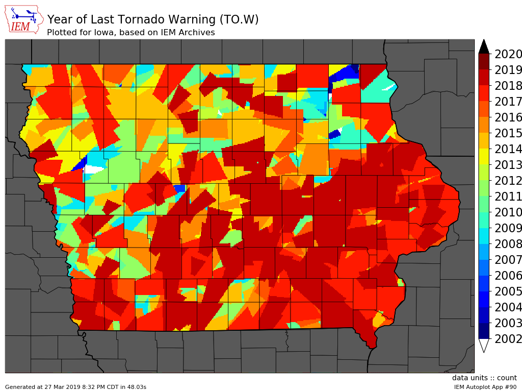
Tornado Warning Collage
Posted: 28 Mar 2019 05:34 AM
This week is Severe Weather Awareness Week with Wednesday featuring the statewide
Tornado Warning drill. The featured map looks like a collage of patches, but represents
the year a location in the state last received a Tornado Warning. This analysis is based on
the storm-based polygons issued by the NWS and not the associated counties included in
the warning. These polygons were not operational until 2007, but were unofficially issued
since 2002. The white slivers on the map would indicate no tornado warnings for that
location since at least 2002.
Voting:
Good = 14
Bad = 1
Tags: tornado
Voting:
Good = 14
Bad = 1
Tags: tornado

