IEM Daily Feature
Wednesday, 06 February 2019
Wednesday, 06 February 2019
'18-'19 Winter Storm #13
Posted: 06 Feb 2019 08:18 AM
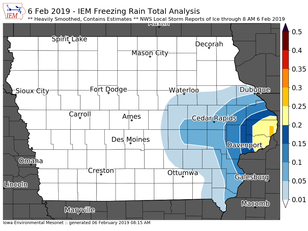
A storm system brought limited amounts of snow to northern Iowa on Tuesday and more
significant accumulations of rain, sleet, and freezing rain over southeastern Iowa. The
featured map is a very crude and smoothed analysis of available reports showing the
highest totals of about a quarter inch of ice near Davenport. More snow and ice is possible
today as our active winter pattern rolls on.
Voting:
Good = 9
Bad = 0
Tags: winter1819
Voting:
Good = 9
Bad = 0
Tags: winter1819

