IEM Daily Feature
Wednesday, 22 August 2018
Wednesday, 22 August 2018
River Stage Forecasting
Posted: 22 Aug 2018 05:35 AM
The recent significant rainfall over west central Iowa has some area rivers on the rise with
some minor flooding expected. The National Weather Service produces river stage
forecasts based on hydrology models and very near term forecasted rainfall. These
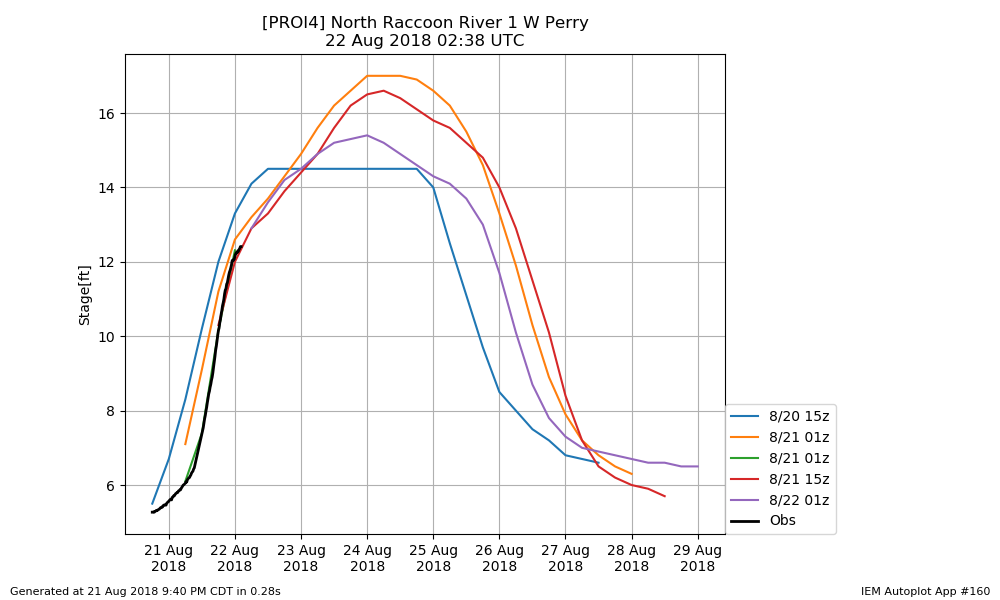
forecasts can be updated multiple times per day. The featured chart looks at the forecasted
and observed stage for the "1 West of Perry" site along the North Raccoon River. The black
line represents the observations and the other lines are recent forecasts. The forecasts
change as better data is made available and the ongoing event is better understood. You
can find forecasts like these and much more on the excellent NWS
AHPS Website.
Voting:
Good = 8
Bad = 0
Tags: stage
Voting:
Good = 8
Bad = 0
Tags: stage

