IEM Daily Feature
Friday, 13 July 2018
Friday, 13 July 2018
Some 110s
Posted: 13 Jul 2018 05:34 AM
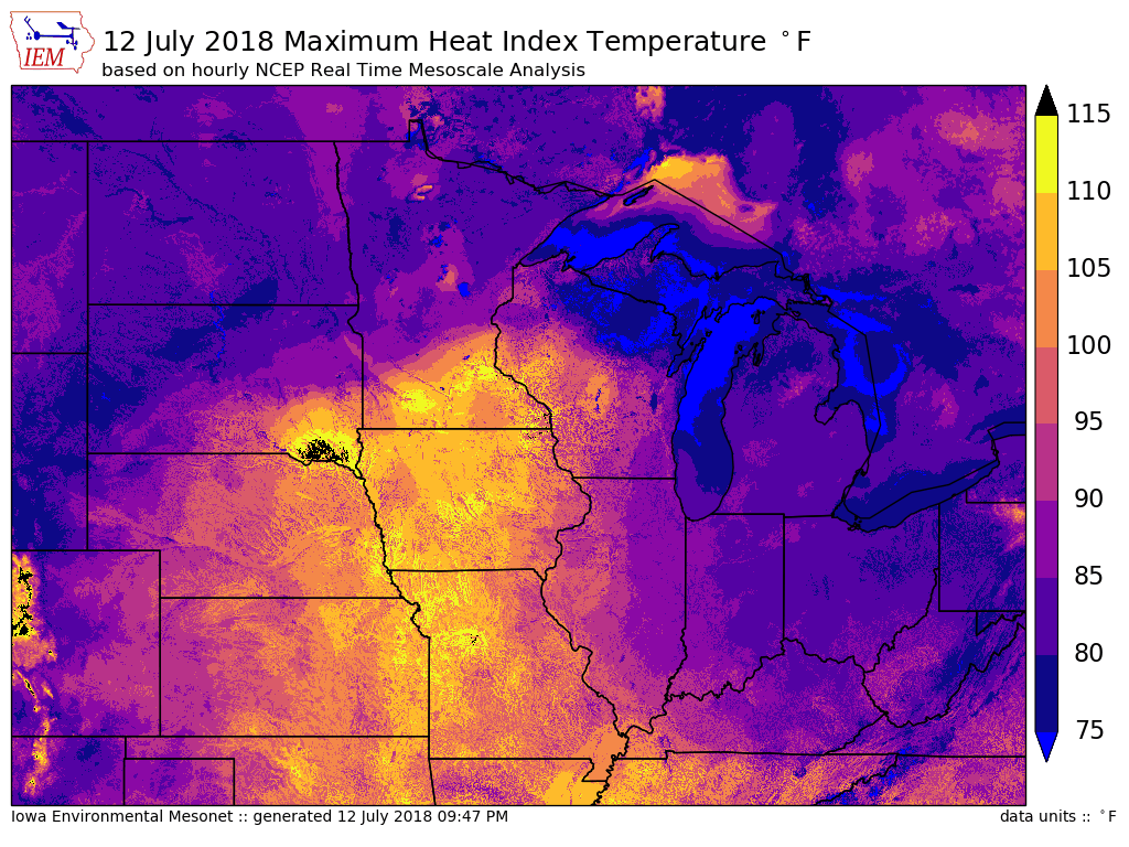
Air temperatures in the 90s and dew points well into the 70s created for dangerous heat
index values on Thursday. The featured map displays a grid analysis of maximum heat
index values based on hourly NWS NCEP data from the realtime mesoanalysis. This
product indicates a few places in Iowa reached 110+ degrees on Thursday and nearly all of
the state over 100 degrees. The current near term forecast has a respite from the extreme
heat and more frequent chances of rain.
Voting:
Good = 17
Bad = 5
Abstain = 1
Voting:
Good = 17
Bad = 5
Abstain = 1

