IEM Daily Feature
Tuesday, 18 July 2017
Tuesday, 18 July 2017
Isolated Shower
Posted: 18 Jul 2017 05:23 AM
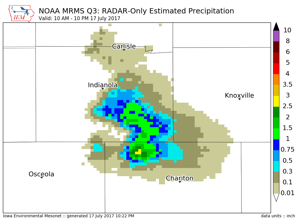
A lone thunderstorm was somehow able to fire over southern Iowa late Monday afternoon and
dumped much needed rainfall over a very limited area. The featured map displays NOAA
MRMS precipitation estimates based on RADAR and shows a very small area just to the
northwest of Chariton and southeast of Indianola picking up an inch or more. This is a critical
time of year to receive precipitation for a corn crop that is currently tasseling. These types of
rainfalls can go a long ways to explaining differences in final crop yield between neighboring
farmers and fields. Hopefully expected rainfall on Tuesday can be a bit more widespread, but
some dry areas of the state will almost certainly miss out again.
Voting:
Good = 17
Bad = 1
Abstain = 1
Voting:
Good = 17
Bad = 1
Abstain = 1

