IEM Daily Feature
Friday, 20 May 2016
Friday, 20 May 2016
East / West Split
Posted: 20 May 2016 05:34 AM
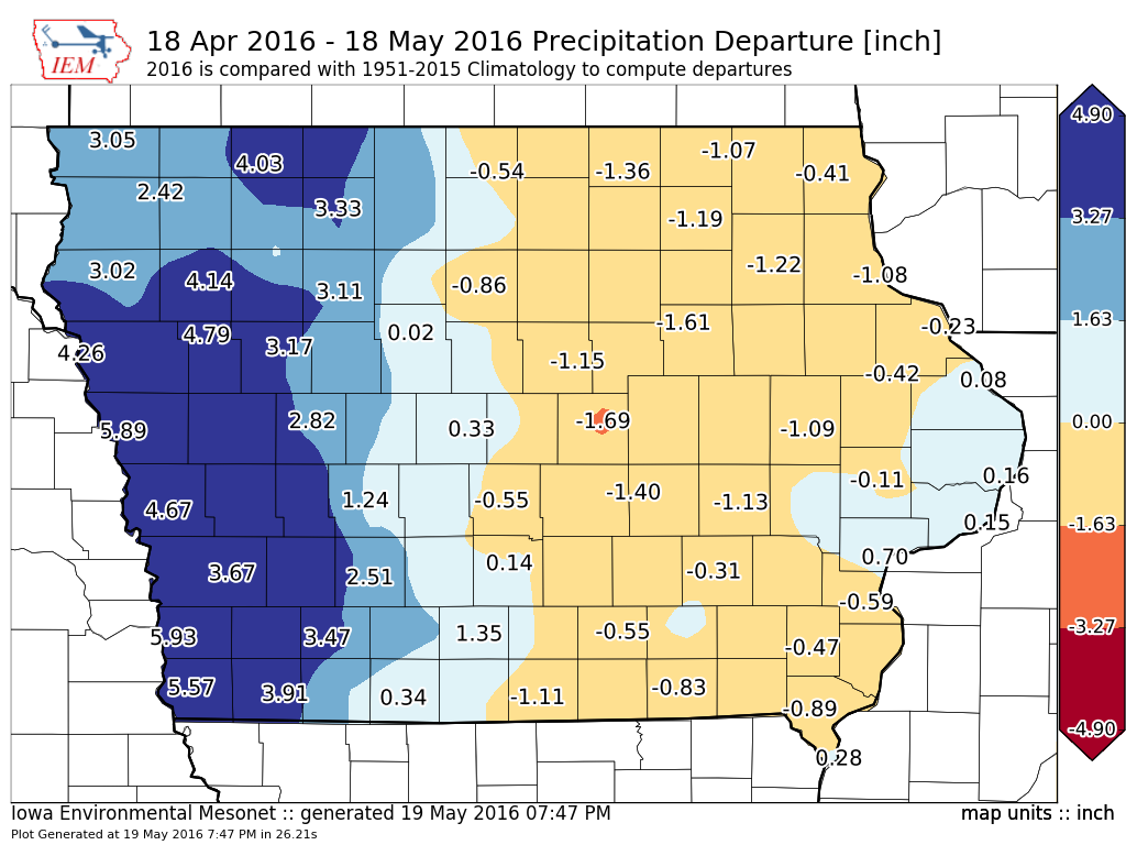
The featured map displays IEM estimated precipitation departures for the past 30 days.
The state is pretty much split in half right along I-35 with the western half having surpluses
and the eastern half mostly having deficits. The forecast for the next week looks to keep
this pattern going with the best chances of heavy rainfall over western Iowa. Temperatures
are expected to warm along with higher levels of humidity to make it feel more like summer
than the early spring that it has recently felt like.
Voting:
Good = 15
Bad = 0
Voting:
Good = 15
Bad = 0

