IEM Daily Feature
Tuesday, 28 October 2014
Tuesday, 28 October 2014
Trap Weather
Posted: 28 Oct 2014 05:40 AM
After a very nice stretch of mid-fall weather, our weather looks to turn cooler.
Temperatures on Tuesday will be a trap for those expecting to see a repeat of the recent
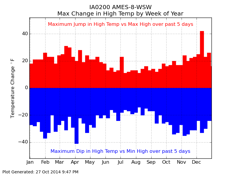
past of warm temperatures. The featured chart looks at the maximum increases and
decreases from a period of the five days of high temperatures. For example, the past five
days for Ames had a high temperature at least above 69 degrees. If the high temperature
on Tuesday is 54 degrees, this would be considered a negative 15 degree jump down for
this plot. The chart shows that the expected change today is still much smaller than the
most extreme on record. The high today would have to be about 39 degrees to match the
shown extreme.
Voting:
Good = 11
Bad = 6
Abstain = 7
Tags: high
Voting:
Good = 11
Bad = 6
Abstain = 7
Tags: high

