IEM Daily Feature
Thursday, 19 December 2013
Thursday, 19 December 2013
Warmup hurts snow chances
Posted: 19 Dec 2013 05:38 AM
Temperatures warmed very nicely on Wednesday with highs some 15-20 degrees above
average for some parts of the state. Are such warm conditions in the winter typically
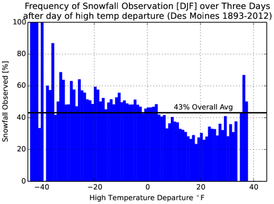
followed by snowfall? The featured chart presents the frequency of having at least one day
of measurable snowfall for the three days following a day with the given high temperature
departure. These values are only presented for dates during December, January, and
February (DJF). A rather smooth signal appears in the chart with the highest frequencies
at temperatures below climatology and warmer than average temperatures leading to a
decrease in frequency. There appears to be an interesting inflection point around +20
degrees above average whereby frequencies actually increase. This can probably be
explained by the most extreme temperature warm ups being associated with intense storm
systems that bring colder weather and snow with the cold front passage.
Voting:
Good = 33
Bad = 4
Abstain = 3
Tags: snow winter
Voting:
Good = 33
Bad = 4
Abstain = 3
Tags: snow winter

