IEM Daily Feature
Thursday, 19 September 2013
Thursday, 19 September 2013
Severe 500mb Flow
Posted: 19 Sep 2013 05:43 AM
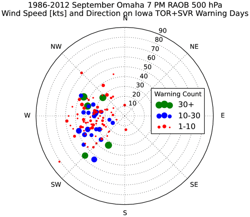
Severe weather looks to be a possibility today with the passage of a
cold front. The featured chart presents the combination of 500 hPa
flow as observed by the Omaha sounding on September days with severe
thunderstorm and/or tornado warnings issued for Iowa. The polar chart
shows the wind direction and speed with the size of the dots indicating
the number of warnings issued that day. 500 hPa (same unit as millibar)
flow is important to thunderstorms as changing wind speed and/or
direction is necessary with increasing height to separate updrafts and
downdrafts in long lived thunderstorms. During the summertime, wind
shear is often weak and so a downdraft will often choke out the updraft
of a storm and limit its lifetime. The chart shows that at least 10-20
knots of wind speed are typically needed for severe events. The
forecasted wind at 500 hPa this evening for Omaha appears to be around
30-40 knots from the WSW.
Voting:
Good = 74
Bad = 11
Tags: sounding
Voting:
Good = 74
Bad = 11
Tags: sounding

