IEM Daily Feature
Wednesday, 09 April 2008
Wednesday, 09 April 2008
Low FFG
Posted: 09 Apr 2008 07:00 AM
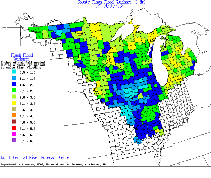
The featured map is of 1 hour flash flood guidance from the North Central River Forecast Center. This guidance is an estimate of the maximum amount of rain that could fall within an hour before flash flooding would occur. Values in SE Iowa are about as low as it gets and the storm coming this Thursday should easily exceed those values. Note, areas shown in white on this map are outside of the North Central RFC's area of responsibility.
Voting:
Good = 24
Bad = 9
Voting:
Good = 24
Bad = 9

