IEM Daily Feature
Wednesday, 14 March 2007
Wednesday, 14 March 2007
Wild swing upward
Posted: 14 Mar 2007 07:32 AM
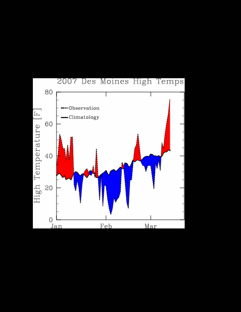
Temperatures were nearly 30 degrees above normal on Tuesday setting record values at places like Des Moines, Ottumwa, and Waterloo. The featured image is a chart of daily high temperatures (dashed line) with the filled area being the departure from normal (solid line). Red areas are temperatures above normal while blue areas are below normal. You can see how our weather cycles from periods of warmer weather to colder. For this year, you can see the warmth of early January followed by the bitter cold of early February and then a brief warmup before the recent storms of late February and early March.
Voting:
Good = 22
Bad = 2
Voting:
Good = 22
Bad = 2

