Past IEM Features tagged: may13
Wet six days
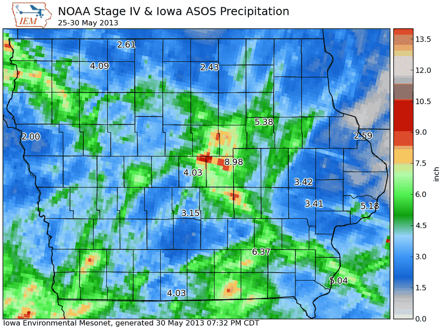
31 May 2013 05:43 AMThe featured map presents NOAA's "stage IV" multi-sensor precipitation estimates for the past six days along with the automated weather station reports. Marshalltown displays the highest value at just under 9 inches! The stage IV estimates show 9-10 inch estimates just west of that location as well. This all adds up to what is a record river level for the Iowa River at Marshalltown.
Voting:
Good: 251
Bad: 34
Tags: may13
6 inch departure
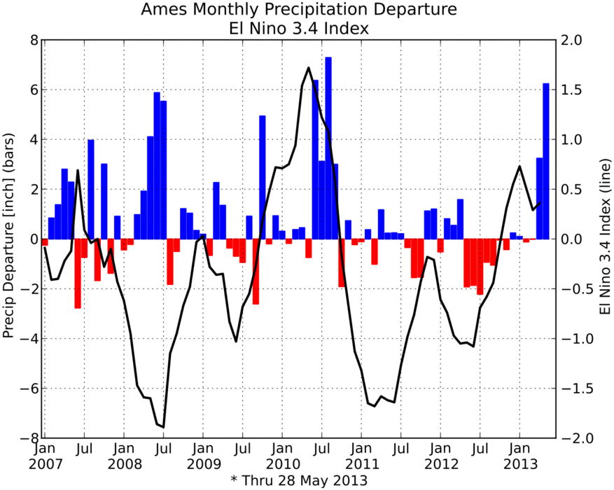
29 May 2013 05:40 AMThe featured chart displays the monthly precipitation departures for Ames along with the El Nino 3.4 index value (determines El Nino vs La Nina). This month has seen over six inches of excess precipitation as compared with long term averages. The departure is the largest seen since the floods of 2010 and there are still 3 days to go in May and plenty of rainfall chances. The El Nino index is provided as our monthly weather is often correlated with it. Do you see any interesting relationship?
Voting:
Good: 81
Bad: 9
Tags: may13