Past IEM Features tagged: dryline

Dry Line over Iowa
11 Mar 2021 05:34 AMWednesday was a very active weather day for Iowa with a strong low pressure system drawing warm and moist air into the state ahead of it and leaving behind much cooler temperatures in its wake. The system prompted the issuance of an early season Tornado Watch, but thankfully the threat did not materialize in the state. One of the reasons for the concern was the presence of a "dry line" boundary, which have a short of nebulous nature but denote a boundary between warm + moist and warm + dry air. These boundaries are more common over the high plains as moist Gulf of Mexico air clashes with dry air from the high plains and dessert southwest. They help to focus lift in the atmosphere and provide wind shear to produce rotation in storms. The featured plot presents a time series from the ISU Soil Moisture station near Castana (West Central Iowa). The plot clearly shows the passage of the cold front at about 2 PM, but the presence of a sharp dry line boundary passage is a bit more difficult to tease out. One dry line boundary convention is to look for dip below a 55 degree dew point, which is denoted on the chart. Please feel free to share your thoughts if you think this plot shows a dry line or not!
Voting:
Good: 13
Bad: 0
Abstain: 1
Tags: dryline
Weather won't shutdown
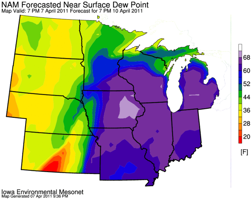
08 Apr 2011 05:53 AMWhile the federal government is expected to shutdown today, our active weather is just getting started. The Storm Prediction Center has a somewhat rare moderate risk of severe weather already forecasted three days out for Sunday. The featured image shows a model's forecast of dew point for Sunday afternoon. The strong gradient of dew point is indicative of a dry line feature that is expected to make it into the state. These boundaries can help focus severe storm development and give them low level wind sheer to become more severe. The other thing to note in the plot is the summer like dew points in the warm sector of the storm well into the upper 60s. Severe weather is possible in our area for the next three days.
Voting:
Good: 25
Bad: 5
Tags: dryline