IEM Daily Feature
Friday, 02 September 2016
Friday, 02 September 2016
Summer Arridity Index
Posted: 02 Sep 2016 05:18 AM
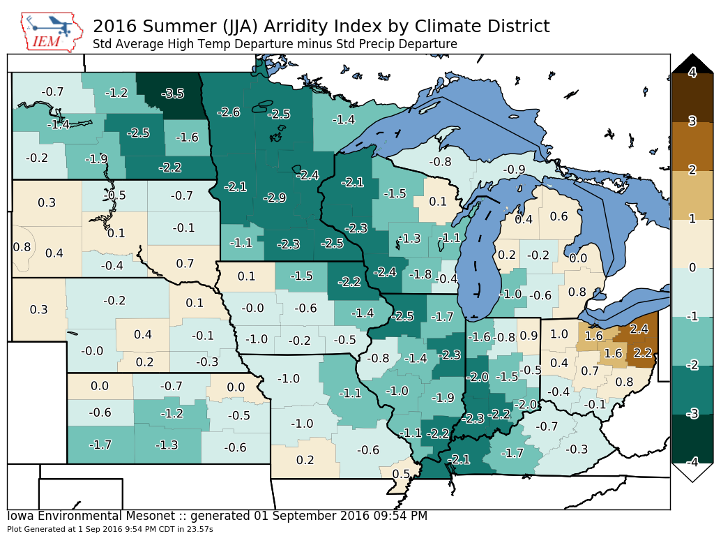
Arridity Index is a combined measure of temperature and precipitation departures. In this
context, the normalized temperature departure is subtracted by normalized precipitation
departure. The featured map displays this metric computed over the entire summer by
climate district. Positive values indicate areas of increased water stress. For the corn belt,
a clear gradient is shown with the far eastern areas under the highest water stress with
much of the western portion showing much less stress.
Voting:
Good = 10
Bad = 2
Tags: arridity
Voting:
Good = 10
Bad = 2
Tags: arridity