IEM Daily Feature
Thursday, 25 September 2014
Thursday, 25 September 2014
Missed Rainfall Forecast
Posted: 25 Sep 2014 05:38 AM
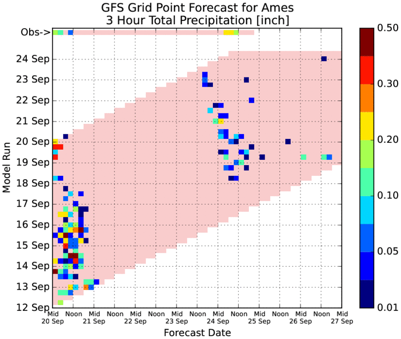
The rain that fell over central Iowa on Wednesday was largely unforecasted by the main
weather forecast models run in the US. The featured chart displays grid point output from
the GFS model for Ames. This model is run four times per day and for this analysis
produces a precipitation forecast at three hour intervals. The top row of data is actual
observations from the Ames Airport and the grid below represents the forecasts made
from each successive model run. Ames picked up over 0.6 inches with some very isolated
values over an inch for Central Iowa. It is interesting to see an event missed like this and
provides confirmation that there is still room for humans in the weather forecasting
process!
Voting:
Good = 15
Bad = 6
Abstain = 3
Tags: model
Voting:
Good = 15
Bad = 6
Abstain = 3
Tags: model