IEM Daily Feature
Friday, 29 June 2012
Friday, 29 June 2012
Potential Instability
Posted: 29 Jun 2012 05:46 AM
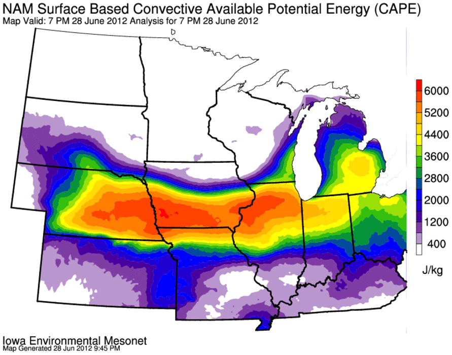
Very hot air arrived in Iowa on Wednesday and muggy conditions were not
far behind. With surface dew points near 80 degrees in some locations,
the lower atmosphere is loaded with moisture. This moisture represents
a potential energy source for thunderstorms as condensing water within
clouds releases heat which promotes upward motion. The featured map
presents a measure of this energy named convective available potential
energy (CAPE). CAPE values above 2,000 are often considered
significant for severe storms, so do the values shown above 6,000 in
Southern Iowa on Thursday evening mean the world is coming to an end?
The key word in the CAPE acronym is potential. Just as a watermelon
sitting on the top of a sky scraper has a high potential to accelerate
if pushed off the edge, the initial push needs to occur. For the
atmosphere, weak winds and little convergence of air often means these
profiles are left unrealized (nothing to give them a push).
Voting:
Good = 41
Bad = 6
Tags: cape
Voting:
Good = 41
Bad = 6
Tags: cape