IEM Daily Feature
Friday, 31 July 2009
Friday, 31 July 2009
Average Temperature
Posted: 31 Jul 2009 06:06 AM
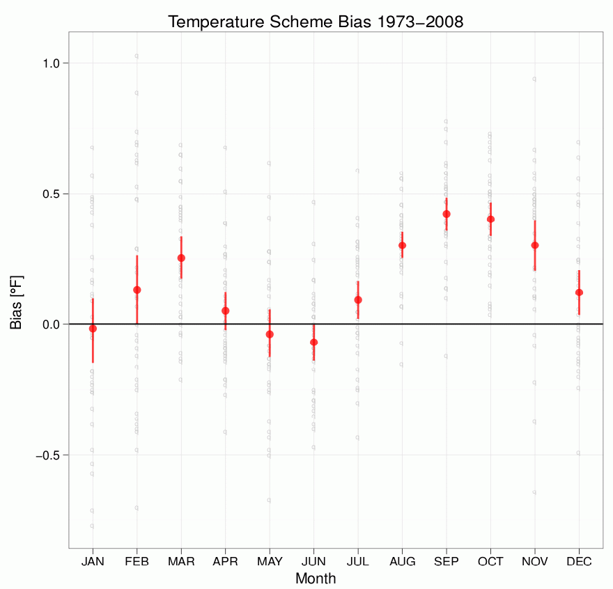
Today's feature is a bit of a thought provoker for you to consider. July's average temperature is expected to be the coldest on record for Iowa, but what is an "average temperature"? Setting aside the spatial aspects, typically this value is the simple average of the daily high and low temperature (since that observation is the most commonly available for the longest periods). Since automated sensors report information every hour, how does a simple average of these values compare with the average of the high and low daily temperature? The featured chart presents the monthly mean biases based on observations from the Des Moines Airport site back to 1973. The positive values mean the simple average of high and low temperature yields a warmer value than the average of the hourly observations. The red bar represents the 95% confidence level for the mean. There is a clear annual signal in this chart, what causes it?
Voting:
Good = 34
Bad = 9
Tags: temperature
Voting:
Good = 34
Bad = 9
Tags: temperature